Importing Geospatial Data Types
Interoperability tools provide several methods for sharing geospatial data. They allow you to:
-
Directly reference supported formats by using the standard MicroStation reference file mechanism.
-
Import supported formats by selecting the file(s), defining the import parameters, and running the import process.
-
Save all the parameters for the import process for re-use.
-
Directly reference a saved import file as a reference file.
-
Directly open a saved import file to run the import process into a new empty file based on the seed file.
The Import module allows for the exchange of graphical data and associated non-graphical property information of a variety of geospatial file formats.
-
ESRI® Shapefile (SHP) import requires at least three files in the same directory, with the same name and following extensions: .SHP (geometry), .SHX (index), and .DBF (non-graphical property attributes for the geometry). In addition to these three required files, it is possible to have additional files with other extensions. For example, .PRJ which stores projection information.
-
MapInfo® MIF/MID (MapInfo® Interchange Format) import requires two files in the same directory, with the same name and following extensions: .MIF (geometry) and .MID (non-graphical property attributes for the geometry).
-
MapInfo® TAB (MapInfo® native file format) import requires a number of files to be present in the folder for import. These files make up a standard MapInfo project.
- GML format supports Version 2.1 and 3.1. At least two files are required. The data file, typically named .GML or .XML and the schema file, typically named .XSD.
-
Spatial databases are imported as read only which prevents editing and posting changes back to the source database. Supported databases are:
There are several ways to customize a geospatial file import. This includes defining the spatial extents of the area being imported, the symbology of the imported features, and what properties will be included. Multiple files can be imported at once.
Note:
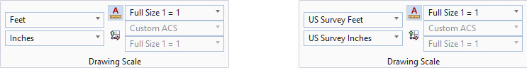
Be very careful of the difference between US Survey feet and international feet. These units are almost equivalent. A US Survey foot is defined as being 0.3048006 meters, while an imperial foot is defined as being 0.3048 meters. Such a small difference scales to a large error when dealing with the large distances encountered in mapping projects.
For best results, set your working units to be the same as the units defined in the coordinate system associated with your design file. For further information on setting your working units, refer to MicroStation Help.